 FlyTheCoastFlyTheCoast
IMG_8937 - Fowl River Marsh destruction from Sea Level Rise

IMG_8970 - NEP Shoreline Restoration Project (Pocket Beaches-SouthCoast Engineers)

IMG_8974 - Mon Louis Point, Fowl River- NEP Shoreline Restoration Project

IMG_8986 - Mon Louis Point- Fowl River Alabama

IMG_8988 - Shoreline Projects on Dauphin Island Parkway

IMG_8990 - Fire in Heron Bay marsh

IMG_8992 - Heron Bay Marsh

IMG_8994 - Osprey survives fire in Heron Bay marsh (Pole compliments of John Dindo,DISL)

IMG_8996 - Sailing on Mobile Bay

IMG_8997 - Little Dauphin Island

IMG_8998 -

IMG_8999 -

IMG_9000 - Fort Gaines on Dauphiin Island

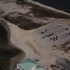
IMG_9001 - Shoreline Protection Project- Sand will fill this space in two weeks!

IMG_9002 - Preparation

IMG_9003 - Pipe from dredge

IMG_9004 - These houses will likely benefit from the sand

IMG_9008 - Pelican Island

IMG_9010 - Fly fisherman at Pelican Island

IMG_9011 - Pelican Island

IMG_9012 - Three houses already replacing 4 that burned on Dauphin Island

IMG_9013 -

IMG_9014 - Good use for holes left by BP oil spill

IMG_9015 - Oyster Farming on Duaphin Island

IMG_9016 - Another interesting use for a "BP hole"

IMG_9017 - The floating dock has landed!

IMG_9018 - Oyster farming at Katrina Cut

IMG_9019 - Paddleboarding the the Gulf

IMG_9020 - Paddleboard/surfing on Dauphin Island
IMG_9021 - Dauphon Island West Beach re-nourished with sand

IMG_9022 - Katrina Cut "Solid as Rocks"

IMG_9024 - Blue Crabs in the Mississippi Sound